Friday: Maintenance Day
Wayne noticed the engine of the coach was missing, so he figured to
replace the plugs. As a result on Friday after a short bicycle ride (the roads
are very soft sand in places and not a lot of fun), he worked on the
coach.
When he was changing the spark
plugs he found that four of the plug wires were damaged and had to be replaced. So a quick trip to Carson City
resulted in new plug wires, a new kickstand for Wayne’s bicycle and a new
California Gazetteer for me.
Andy helping Wayne change the plugs
We spent
the rest of the day installing things and checking out the new map. We're not sure of which route to take. We hear
that Highway 395 is beautiful but there is snow up there. Highway 95 through
Nevada would have less snow but would be less scenic. Maybe I’ll see if California has traffic
cameras on 395.
 Saturday: Dual Sport
The temperatures have been rising both at night and during
the day. It was nice to dress for riding
today with far fewer layers of clothing than I had when riding to Mitchell.
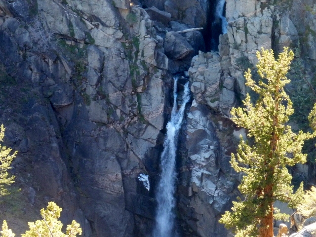
Today Wayne and I rode 101+ miles in the Pinenut ORV-BLM area where we are
camped. We started through areas of sage and Juniper, then climbing into the
Pine Nut Mountains and over Sunrise Pass.
Occasionally
we found an area of deciduous trees that stood out because of their fall
colors.
At
the junction we decided to see where the Sunrise Pass Access was.
We
ended up on Artisia Rd, a gravel road with no town in sight. So we turned
around and headed back, taking a small road up to one side, to see if it went
over the top of the mountain. It didn’t,
so we stopped in a grove of Aspen trees for lunch, and then headed back to the
Sunrise Pass road.
Next we headed towards Churchill Canyon.

Along the way we saw what
looked like a large back hoe working off in the sage brush.
It turned out to be a huge brush cutter.
It was mowing down Juniper trees. We had seen
the results of this during our drive through Oregon and wondered about how and
why the trees are being removed from range land.
Now we know the how.
This machine can mow through a full tree in
less than a minute, leaving just a pile of sawdust, branches and debris.
As for the why, I looked up Juniper removal
and found that it “has subtly been invading vast acreages of rangeland in the
west that were once dominated by sagebrush, grasses, and forbs. Juniper is now
estimated to occur on more than 5 million acres in Oregon alone. Although
juniper is a native plant, fire suppression and other factors have allowed this
tree to expand to
sites it never occupied
historically. As juniper
expands its range, it gradually results in a number of resource problems, such
as reduced forage production, increased soil erosion, altered wildlife habitat,
and reduced stream and spring flows. Besides
affecting a rancher’s bottom
line by reducing forage production, juniper invasion is severely impacting
rangeland wildlife
like mule deer and sage-grouse.” (Natural Resources
Conservation Services website) Hmm. When conservation groups state that they
want to return nature to its historically correct state, I wonder why.
After all, the earth is continually changing,
it’s called evolution and I don’t think they can stop it.
If the trees are invading naturally, if man
is not transplanting them there, why are we messing with Mother Nature?
Yes we like deer and grouse, but nature has a
way of controlling the size of flocks and herds to sizes that may not be as
plentiful as hunters would like them to be.
So who are we helping, the wild life or the ranchers and hunters?
Okay, that’s my rant for the day, back to the ride.
After abandoning the road to Churchill as too flat and boring,
we returned to the road to Dayton. The road was in horrible condition, full of shale and rock beds. We
stopped several times to decide; do we go forward or back? It was rough and
rocky, and 18 miles long. We kept going,
thinking it couldn’t be this bad the whole way.
It was bad, but not the entire way. It did eventually get better. We went through several recent fire areas and
were amazed to see people with trucks and trailers out on that crappy road,
cutting wood.
Recent fire section, open to woodcutters
Then we broke over a small pass, seeing the snowcapped
Sierra Nevada’s in the distance. With those in sight I could find our way back
to the motorhome.
There were the remains of an old building at the pass, and in the distance, proof of civilization.
 Going over the pass took us out of rangeland and in to
mining country. We passed old buildings
and big holes in the ground, nice to see they were surrounded by fences and
warning signs. We continued down to Dayton and Highway 50. This took us to Carson City and another
entrance into the BLM Land through Brunswick Canyon. I have to take a moment and thank the very
nice folks in the Sheriff Search and Rescue trucks. They were coming back from
some sort of water event (wearing their logo shirts and pulling a nice looking
boat). They took the time to help us find the road to Brunswick Canyon. They sent us up Sedge road which turned into
the canyon, from there it connected with the Sunrise Pass Road we are camped
on. 101.88 miles and we were back before 5 pm, it was a great ride.
Going over the pass took us out of rangeland and in to
mining country. We passed old buildings
and big holes in the ground, nice to see they were surrounded by fences and
warning signs. We continued down to Dayton and Highway 50. This took us to Carson City and another
entrance into the BLM Land through Brunswick Canyon. I have to take a moment and thank the very
nice folks in the Sheriff Search and Rescue trucks. They were coming back from
some sort of water event (wearing their logo shirts and pulling a nice looking
boat). They took the time to help us find the road to Brunswick Canyon. They sent us up Sedge road which turned into
the canyon, from there it connected with the Sunrise Pass Road we are camped
on. 101.88 miles and we were back before 5 pm, it was a great ride.
Sunday: Ride Day, Wayne
Greg came to take Wayne for a ride today. They
did about 50 miles, most of which were single track trails. They started in the sage and sand washes and
then moved into the Pine Nut Mountains to ride in the Pinion Pines and
Aspens. Greg says there are hundreds of
miles of trails in the local mountains.
We’d like to come back next spring when we are heading north for the
summer.
Monday: Virginia City and Lake Tahoe
Today we took the truck and
went to Virginia City to play tourist. I
didn’t realize that at Silver City you have to make a choice; you come to a Y
in the road and the sign says that both ways go to Virginia City. One way indicates trucks and RV’s, so we
picked the other road. Next came the
sign that warns of 15% grade to come. Glad we were in the truck. We never saw the other route, but I’m
guessing that it is not near that steep.
 The road was very cool, and
evidence of mining was everywhere.
Virginia City sits directly
above the Comstock Lode which produced more than $400 million in gold and
silver. Most of this occurred during a
20 year span in the mid 1800’s. It was
amazing to visit the museum and see the models of how all the tunnels run under
town. And the equipment they had to use!
The town itself looks great
considering its age.
The road was very cool, and
evidence of mining was everywhere.
Virginia City sits directly
above the Comstock Lode which produced more than $400 million in gold and
silver. Most of this occurred during a
20 year span in the mid 1800’s. It was
amazing to visit the museum and see the models of how all the tunnels run under
town. And the equipment they had to use!
The town itself looks great
considering its age.
The Masonic Temple looks
newer than other buildings
 The Suicide Table is named
so because three of the owners (dealers) lost their fortune and suicided on the
table. So they say…
The Suicide Table is named
so because three of the owners (dealers) lost their fortune and suicided on the
table. So they say…
I like the name of this place!
We had to visit and mail
post cards to Mom and Becca
The Brewery is not open at
the moment, much to Wayne’s dismay
From Virginia City we continued up and over Geiger Summit
and down into the valley south of Reno, under US 395 and back up the other
side. And up is correct, the elevation
signs were zipping by. So were the ski
areas, we must have passed 3-4 on the east side of Mt Rose Summit which is at
an elevation of over 8500’. Down the other side past another ski area and we
were at Lake Tahoe. Here we opted to
stay on the west side of the lake, as the sun was headed down over the hill and
the east side is a much longer route.
We were both surprised at how large this lake is and the
water is so clear!
Tonight is our last night here, tomorrow we head south on US
395. We decided to go through California
Mountains rather than the Nevada desert.
We hope to do some riding along the way.


 This road is steep and the curves are very tight. There are
signs warning that trucks and vehicles with trailers should not go this way,
however that didn’t stop one truck driver who got in over his head and jack
knifed his rig in a corner. We weren’t
sure we could get by but a guy on a big Harley said we could get past if we
didn’t mind going on the soft gravel. If we didn’t mind… CHiP’s was on site when we got up to where
the truck was. They let us go by because
as one officer said “I would if I were on that bike”.
This road is steep and the curves are very tight. There are
signs warning that trucks and vehicles with trailers should not go this way,
however that didn’t stop one truck driver who got in over his head and jack
knifed his rig in a corner. We weren’t
sure we could get by but a guy on a big Harley said we could get past if we
didn’t mind going on the soft gravel. If we didn’t mind… CHiP’s was on site when we got up to where
the truck was. They let us go by because
as one officer said “I would if I were on that bike”.