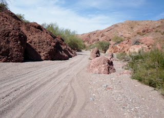
Good news!! I got a new camera, finally!!!
After being alone for 2 weeks, our friends have come back to
Quartzsite. We were getting lonely, and
we had run out of rides that we had GPS tracks for. We needed the experts to
come to the rescue. And they did!! Once
Bill, Rainer and Maria, and Bob and Cindi all got settled in, Bill planned a
ride that would have us loading up the trucks and heading south. |
| 7 bikes/riders and 2 return drivers made the trip |
We drove about 70 miles south on SR 95 to Martinez Lake.
There we unloaded the bikes and said “Thanks” to our drivers
Jerry and Sue
Bill
prepping his stuff
We started through the Imperial Wildlife preserve and headed
north through the Painted Desert.
Nice
day for a ride
The
hills were very colorful.
So
much rain this year means the flowers are everywhere.
Our first stop was the Red Cloud Mine. This minewhich started as a silver mine has been
here in the desert for a long time. The Red Cloud Mine is only one of several
places in the world that produces gem quality Wulfenite.
Gem
quality Wulfenite
This is really interesting! These holes along the wash banks
(there is quite a few of them) were miner’s homes back when the mine was going
gang busters. You can see the chimney pipe stuck up out of the ceiling of the
tunnel for the stove.
 The mine has a full time caretaker, who doesn’t let anyone
onto the property just to look. He was an interesting fellow. He told us many stories, many of which had
our bulls**t meters pegged. I like the
one where he claimed that 2 fighter jets from the local military proving
grounds ricocheted off the tower, leaving so quickly he didn’t get their
license numbers!!! We told him we were glad we were wearing boots; the bull was
so deep, so he told us that the tower had actually been dropped several times
while being installed. That one we
believed!
Wayne
at the mine
Rainer takes a small break, before he gave up to the flu and
headed back to camp.
The
pack
After leaving the mine we continued on, turning off the dirt
road, and heading up this hill. The
jeepers we saw on the road said they didn’t like that route. I can see why.
Yes, sometimes we get into places that take all of us
working together to get us all up the hill.
After taking his bike up, Wayne comes back to get my
bike. He knows I suck at this kind of
stuff
Cindi
heads up through the rocks
She
passes Bills bike
Bill
gives her a hand
Off she goes, just as Wayne is coming back to get Maria’s
bike for her. Maria rides a small Yamaha
TTR 125, with little wheels and no power.
This is not a place that it works well.
Wayne
takes Maria’s little bike upthrough a rough section.
The
view from the top, worth the trip!
Wayne had brought Maria’s and my bike up through the worst
of the rocks, but it was only part way up.
Then he headed down to help Rainer who was very sick with the flu. Rainer decided to head back, so Wayne rode
part way out with him. Maria and I still
had to get up to the very top.
Wayne soon caught up with us and we grouped back up at top.
Then it was down the other side and into a wash to find
shade for lunch.
Maria and Bob at lunch
Wayne
and Bob
After lunch we headed down to the Clip Wash. This is a corridor through the Trigo
Mountains Wilderness Area. It is also
ten miles of deep soft hard to ride dry wash.
Yes,
10 miles of soft ruts.
I had to stop once when my hands cramped up, right next to
this arch.
Finally we get to the end of the wash and head out through
the Cibola Wildlife Preserve along the Colorado River. Then we get onto the Ehrenburg-Cibola Road
and head out through the desert again.
One of the realities of following a GPS track somewhere you
have never been is that you spend a lot of time figuring out where in the world
are you, and is it where you are supposed to be?
Nope,
we go that way
We’re
turning around again?
Bob,
Cindi and Maria
Patti
and Wayne
Finally, a place I recognize. This is the Power line road that you can see
from I-10 as you head east from California toward Quartzsite. It is much steeper than it looks in this
shot.
Patti
headed up the Power Line Rd
This is taken from the top, and shows a little better how
long and straight this road is. It
starts at an elevation of about 900’ peaks at 1700’ and then goes back down to
1000’ all in about 6 miles. From here we
went around that hill on the left, caught the paved Pipe Line road into
Quartzsite and home, after 100 miles. It
was a great ride.


No comments:
Post a Comment