Welcome

Welcome to my online journal. This is the log of our motorcycle adventures as well as camping with the Grandkids. If you would like to see more of the country, from the seats of our motorcycles, then check back anytime!

Saturday, April 13, 2013

April 9, 2013 -- Wilson Canyon, NV

Wilson Canyon is an ORV area located between Yerington and Wellington NV on Highway 208. This area on the south side of the road is Humboldt-Toiyabe National Forest and the north side is BLM. We camped beside the West Walker River. We arrived rather late in the day, after spending a lot of time running around trying to find this place.  It was still cold outside; after all it had been snowing on and off all day.
Screen shot of our route
I should have known what kind of day it was going to be by the way it all started.  We headed down the road we were camped on, Copperbelt Rd, only to run into a locked gate with No Trespassing signs.  We couldn’t find a way around it, so we went back to the rig and my Topo program, to find a way to connect with our route farther out.  I didn’t know it then, but today would show us how smart our friend Jim is.  He has just bought the GPS I want, and he said for what he does, carrying a “throw away” laptop with him in his pack is a must.  That way he has the ‘bigger picture’ Topo program with him.  As you will see, we could have used that today.
 
Try 2:  We headed out to the highway and circled around the closed area, joining up with the route on the Delphi Rd headed to Mason Pass. 
 We got fairly close to Highway 95A before swinging west past the Yerington Indian Reservation-Campbell Ranch.
Deserted mine with old windmill
 We followed the sometimes paved road up toward a large mine before heading north to Churchill Canyon.  We popped out onto that road just where I thought we would.  Wayne and I were here last fall.  (See October 2012 post Johnson Lane) we then turned west and went past that horrible rocky road we took last year, and went up and over Sunrise Pass.

We got up into the snow, and the road was very gooey.  We all commented on how bad the traction was; no wonder! Our tires were completely encased in this slimy mud. 
No traction here!
 
 We had to scrape as much as possible off at lunch, for fear that it would dry like concrete and because it weighed a ton!!

Wayne cleaning mud off under his fender 
Bob working on his bike
We stopped for lunch very near where Wayne and I camped last fall. After lunch we headed around the loop and headed southeasterly, at least until we got to another locked gate.  This one was on Indian land. So we headed back to see if we could find a way around. We did manage to find what my topo program would later say was the best route around, so all was good.

 
Once back on track we came to this abandoned home site.  It is currently a registered mining site, so we didn’t stay long.  From there we headed up. 
 Several times our route was clogged with snow.  As we were looking for a route we came across Rd P014, which turned out to be the Lone Pine Canyon Rd.  This is where we could have really used a laptop with the topo software on it.  We kept trying to go down into a valley, to the west that we thought might get us where we wanted to go but didn’t know if any of the roads went through (they didn’t). 
We were trying to get there!
The route I originally created did go through, but it was covered in snow and very steep.  We spent over 2 hours up on top trying to get past the snow. Of course we were at 8700’, what did we expect?  Yes I learned my lesson; I will check elevations when designing routes in the future!  Finally we turned around and back tracked until we could see a town in the 
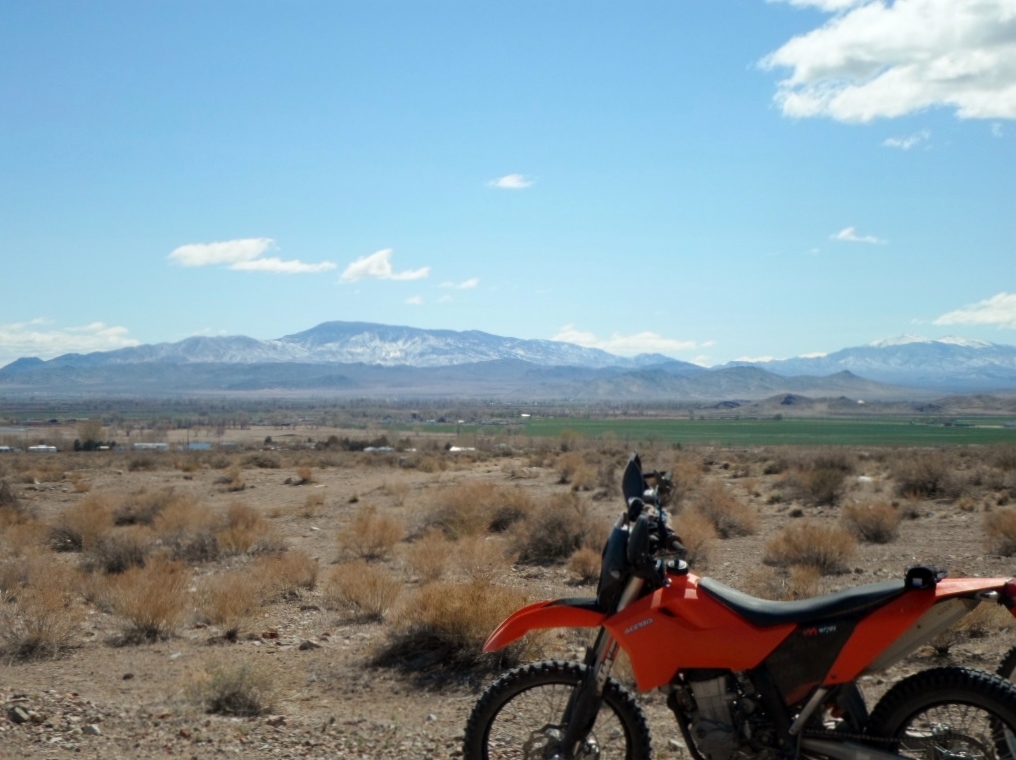
distance, and then headed for it and Highway 395. 
If we had that laptop we would have known that Rd P014 would take us down to either Highway 395 or to roads that went over lower passes to get back to camp.  Although it was getting late, so the highway was probably our best bet to get back before dark. We got back around 6:30 PM.  What a ride!

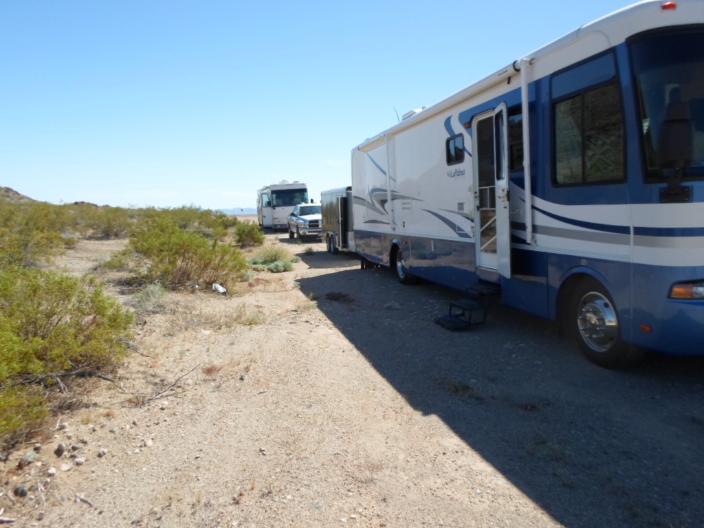
Bob decided to head back to Oregon or at least as far as he could get that night, making it possible for him to be home the next day.  We are back to being just the two of us until we get to his house in a week or so.

April 7th & 8th, 2013 – Winter Returns to Mina Nevada


When we left Beatty the plan was originally to camp at an air field near Coaldale on Highway 95.  When we got there it was a dead town, and the area around it looked pretty uninviting. 
Bob and Wayne checking out the air field as a camp site
Bob and Wayne took the pickup truck out to the air field to see what they thought about getting the coaches out there. They came back and said that although access was good, with the wind picking up it was a very exposed location and not that great a place to camp.  So we hopped back in our rigs and headed to Mina.
Mina was founded as a railroad town in 1905 and was named for Ferminia Sarras, a large landowner and famed prospector known as the 'Copper Queen.' The Nevada & California Railway had a station in the town. The railroad is long gone, but at one time a local shuttle called the "Slim Princess" allowed Native Americans to ride for free on top of the railcars, and passengers and crew would shoot wild game such as jack rabbits, ducks and sage hens from the open windows. The train moved slowly enough that hunters had time to retrieve their game and hop back on board.

Mina is still an unusual place.  This is the Desert Lobster. “You don't see many yachts in the Nevada desert... Bob Eddy, the owner, tells it like this. He found this yacht in Texas, burned up and totaled. At least the insurance company said it was totaled. But not Bob! He bought it and had it shipped up here to Mina, NV where he wanted to make a restaurant out of it.” Tom M, Carson City via YELP

We couldn’t find decent free camping near town, so we decided to stay at the RV park in town.  Once we were set up Wayne and I went to introduce ourselves to the neighbor with the KTM parked next to his trailer.  As we walked up I noticed he had Washington State plates on his truck, and Wayne realized that he recognized him from racing at the Puget Sound Enduro Riders (PSER) events in Shelton, WA.  Jim comes down from Washington to spend the fall and spring here each year.  He had maps and information about the area.  I had already mapped out a route for the afternoon ride, and Bob had done one for the next day.  Jim thought my ride through Volcano Canyon might be rather tough as the road gets washed out during the rainy season.  We thought we would try it anyway.


We left camp about 3 pm, a little late in the day, but I just had 43 miles planned, and it stays light until after 7 so I thought we’d be ok.  It turns out that Volcano Canyon Road does wash out because most of it runs right up the wash.  I thought he meant deep washouts running across the road  which would have been a pain, but this just meant that the road was hard to find in places.  I had a few wrong turns, but we managed to get back on track, only to have a road closure change our route.  Good thing Bob’s GPS has a map in the background so we could see that the road we were on would go to the highway.  I still haven’t got my new GPS, I’m waiting till I get to Oregon where they don’t have sales tax.  Arizona and Washington have close to 10% state sales tax, and my new GPS will run me about $600 so I would rather put that $60 toward extra software, thank you very much.

When we got to Highway 361, the weather was changing quickly.  We took a moment to put on more clothing and rain coats; and decided to go back via the highway.  It was a good call, the weather closed in enough to make it get dark earlier than we expected.  And it was cold!

That night the wind howled and rocked the coach most of the evening.  During the early hours of the morning the fog rolled in and it started to snow.  No ride today.  We took our time getting on the road, just making the 11 am check out time, and headed up the road to Yerington. 

We drove through snow flurries most of the way to Yerington.  We got there about 1 pm and during lunch researched camping in the area.  We found something interesting, a free BLM campground named Wilson Canyon, which has ORV parking.  From its location 20 miles south of Yerington on Highway 208, it appeared to be the south entrance to the Pine Nut area we rode out of Minden in the fall. (see October 2012  post Johnson Lane, Minden NV) We decided we’d go there.  I had an address that I put into both my TomTom and my phone’s Google Maps.  When we got to the junction of Highways 208 & 339, Wayne was in the lead, and my phone said one way and TomTom said the other.   Imagine Wayne’s response when I told him first to turn left then half way through I changed my mind and had him come back onto Highway 208.  We continued on about half a mile until we got to a narrow canyon where I had the boys pull over and wait as I went east, then west, then back east and finally back west until I found what we were looking for.  But find it we did.  A nice big place where we can park off the highway, not get bothered by traffic and the cats can go outside and play.
The weather is due to improve tomorrow, and we have a ride planned.  Life is good!

Thursday, April 11, 2013

April 5th & 6th 2013 – Beatty Nevada

We joined Bob in Beatty around 3 pm.  He had spent the day riding around town on his bicycle.  Not much to town he says.  He did meet a new friend, Rupert.  Rupert owns a motorhome just like Bob’s, as well as a few Harleys, sport cars and a couple of Lola racing cars. In the 1980’s Rupert raced Lola’s in the Can-Am Series.  He also started and ran for 10 years the Bragg-Smith Corvette Driving School in Pahrump, NV.  Currently he is transforming on old NAPA Parts building.  He covered the blue metal building with bricks, you’d never know how it started it’s life.   He's working on the inside, and it's going to be beautiful.
We spent the first night in Beatty parked behind the gas station.  Big trucks would stop, leaving their motors running while they went inside to get food and snacks.  After dark it actually quieted down enough that we could sleep.  But it was not a place where the cats could go outside. So in the morning we went over to Rupert’s in case he knew of a good place for us to camp.  He did. He has a huge piece of land near the airport. It was originally developed and has some infrastructure in place.  It's strange to see the fire hydrants and electrical services out in the middle of the dessert.  We moved out to his land, and the cats love it. 

After setting up camp we unloaded the bikes and went for a ride. We are camped at about 3000’, and our ride into Death Valley had us at least 25’ below sea level. I know we climbed as high as 5700' that day.  From one end of the spectrum to the other!
 
 We started over Daylight Pass and down through Hell’s gate.  We went north through the valley to Scotty’s Castle.  "Scotty's Castle is a two-story villa located in the Grapevine Mountains in Death Valley National Park. Scotty's Castle is not a real castle, and it did not belong to the "Scotty" from whom it got its name.  Construction began on Scotty's Castle in 1922, and cost between $1.5 and $2.5 million. Prospector, performer, and con man Walter Scott, known as “Death Valley Scotty”, convinced Chicago millionaire Albert Mussey Johnson to invest in his gold mine in the Death Valley area.  While out west looking at the 'mine', Johnson fell in love with the area and purchased property to build a winter home on.  Unknown to the Johnsons, the initial survey was incorrect, and the land they built Death Valley Ranch on was actually government land; their land was further up Grapevine Canyon. Construction halted as they resolved this mistake, but before it could resume, the stock market crashed in 1929, making it difficult for Johnson to finish construction.  Johnson willed Death Valley Ranch to a religious organization, with the provision that Scotty could live there as long as he wished. Scotty’s Castle was never completed, but Scotty lived there until his death in 1954. He is buried above the castle."...www.nps.gov
The castle grounds now include a picnic area where we stopped for lunch, and met up with 3 guys from Utah.  Two were riding KTM’s and the third was on a Husqvarna.  Small world, we actually had met one of the guys last summer at Leadore while riding with our mutual friend Charlie.  We had planned to have a GPS track to follow on this ride, but due to electronic malfunction (couldn’t be me, wasn't my GPS) we didn’t have one, so we were going to come back via the pavement and Highway 95.  These guys however were going to Beatty via dirt roads.  They let us tag along for the ride!
Our new friends 
It was about 120 miles and a great time was had by all.
 
On Saturday we headed east out of Beatty on the Fluorspar Canyon Road.

 
 We stopped at a mine to check out the huge hole in the ground. Then it was up Tates Wash and around the hills to the edge of Nellis Air Force Bombing Range. At the place where we turned south we expected to find a historical site, what we found were testing wells, Geological survey markers and a piece of a race truck left behind from one of the Vegas to Reno off-road races.


Remnants of races past
From there we went south back to Highway 95 where we crossed over to the west side and headed out into the desert in Amargosa Wash. We got back on part of the race course and headed back over to Death Valley Park to catch the Chloride Cliffs road up to the Keane Wonder Mine. 

One of the locals?
We aren’t sure, but I think we were in an area that is closed.  The only sign we saw was after we had lunch sitting at the mine, then rode up higher and saw some other entrances to the mine as well.  “The Keane Wonder Mine was one of the most successful gold mines in Death Valley. Miners were following a rich vein of ore that was deposited in fractures in the metamorphic rock. Tunnels were dug; side tunnels were added, always removing as much ore as possible. Eventually the mine became a series of chambers supported by pillars. So much material was removed that the entire mountain slope above became unstable and started to collapse. Besides the obvious danger of entering a crumbling mine, just being on the surface above or near the mine has become a safety hazard.”…www.nps.gov

opps, we may have been in a bad place...


From there it was up and down, and around to Daylight Pass and the paved road out of Death Valley. 
Once we got close to Beatty we took a side trip to the ghost town of Rhyolite.  "The town began in early 1905 as one of several mining camps that sprang up after a prospecting discovery in the surrounding hills. During an ensuing gold rush, thousands of gold-seekers, developers, miners and service providers flocked to the Bullfrog Mining District. Many settled in Rhyolite, which lay in a sheltered desert basin near the region's biggest producer, the Montgomery Shoshone Mine.  The town had a very advanced infrastructure, including piped water, electric lines and railroad transportation that served the town as well as the mine. By 1907, Rhyolite had electric lights, water mains, telephones, newspapers, a hospital, a school, an opera house, and a stock exchange. By 1920 the town was all but deserted due to falling prices and mine closures"...www.nps.gov
This casino is still in pretty good shape, in fact the whole town is in better shape than other 'ghost' towns I have been to.

Then it was back down to the highway and back to camp. We spent another night camped on Rupert’s property.  We really appreciated that he let us camp there.


April 4, 2013 More Bad Luck

This is really not our year. If you haven’t already, check out our post titled “If Not for Bad Luck.” The answer to the question at the end, “will this ever end?” is apparently a big fat NO!

When we went to Tucson after picking up the coach in February, we had issues with the motorhome. We decided to continue on to Tucson before returning to Wickenburg to have the motor (the new motor) looked at.  While in Tucson, the DirecTV receiver decided to malfunction, so we did not have satellite TV. Our electronic issues continued as my computer and tablet refused to talk to my hot spot.
When we got to Wickenburg, it turned out that the cam sensor was getting wiped out by a gear on the cam that was incorrect, and we spent 3 nights at the shop again. Chevy picked up the tab this time. While there I had to take my laptop in to get all the viruses removed.

So with the coach working again we headed back to Quartzsite to spend the rest of March with Bob and Cindy, Sue and Jerry and Bill and Kris. We had a new receiver sent from DirecTV, only to have our TV pitch a fit and die.  We took a day and drove to Avondale to pick up a new TV.
Following Wayne, once again
Broke down on the side of the road, again...
The end of the season has come, and we left Quartzsite on April 2nd.  As we headed into Nevada the coach began to run really badly and it once again set the Oxygen Sensor code with the Check Engine light. We contacted the shop, and they felt it might be injectors. So we called around and found some at a Chevy dealer in Vegas. We managed to limp the coach up to Railroad Pass and spent the night in the casino parking lot. We had a 9 am appointment at the Chevy dealer to install injectors, if that is what tested defective.  They kept it all day and decided they couldn’t find any reason for the code (no one has yet to figure that one out), and that plugs and wires were the reason for it running rough.  Really?  Plug wires? The plugs were new with the motor, but the wires had just been replaced when we were in Minden in November so Terry reused them.  We lucked out; the dealership didn’t charge us for the diagnosis.  Saved us some money there; I think they felt sorry for us because we were still having problems with this brand new motor.   Of course they did want to charge us $500 for a new set of wires, installed.  And those were stock wires, and we have now melted 2 sets of regular wires, so we opted to order high temp wires from O’Reilly's. 

We couldn’t get the wires until the next morning which meant we were limping the coach to a RV park, Arizona Charlie's.  Once there we used the time to run errands.  In the morning we drove to O’Reilly's at about 8:15.  As we are going down the road, Wayne says “Hey something is not right in the back of the truck.  We only have one bicycle.”  Yep, someone had lifted Wayne’s bike during the night.  I was really surprised because I had reminded him to lock them up before we left Quartzsite.  Good thing is was his bike they took and not mine!! Plus he’s been checking Craig’s list for mountain bikes for a couple of months now.
My bike is very lonely now
After picking up the plug wires, Wayne installed them. He found that one of the existing wires was not firmly attached to the plug and was probably the issue.  At 9:15 we had a phone interview with Amazon.com to work as part of their Camperforce.  Amazon hires ‘mature’ labor for the busy season – October to Christmas.  The pay is ok, but they also pick up the cost of your RV spot for the whole time.  We figure we’ll try it this year, it could be a hoot!  And with the year we’re having, spare cash is always a good thing. After all we are still planning a trip to Florida the following January-March, 2014.

After the call we headed to Discount Tire to get new tires for the truck I drive.  I didn’t realize how worn the tires were, after all we got them in 2011.  But it turns out we had put 40,000 + miles on them!  And one had a screw in it.  I feel safer now.
After getting tires on we headed to the Costco Gas station to top off the coach.  As we finished Wayne got some good news, the cylinder he had sent to Kustom Kraft in Henderson to get recoated was done and we could pick it up.  Good, maybe the Gas-Gas will be up and running again soon.  Yeah!

We had planned to go to Caleinte NV to ride, but with all the delays we decided to bag that idea and headed out highway 95.  Bob was waiting for us in Beatty.  As we pulled in Wayne was complaining that the coach was missing again.  So he got underneath and found a different wire had come off and melted on the hot motor. Good thing he had kept some of the other wires as spares!
So I ask again…  Will this ever end???