Welcome

Welcome to my online journal. This is the log of our motorcycle adventures as well as camping with the Grandkids. If you would like to see more of the country, from the seats of our motorcycles, then check back anytime!

Saturday, October 12, 2013

October 8-10, 2013 - Travel to Reno

On Tuesday we left Idaho City, headed for Reno.  As always we had many good rides and a lot of fun in Idaho. We will miss all of our friends that we spend time with there, but we’ll return next year after we ride the Trans America Trail, also called the TAT.  The TAT starts in Virginia and ends in Oregon, staying on dirt roads 80% of the way. We decided to pre-ride part of it on our way to Reno.


We started down Highway 21 towards Boise
Fall color is coming to Boise
We traveled south on Highway 95
I planned our route on my computer, planning to camp along the highway about 15 miles north of McDermitt NV. I found an area that was on BLM land, and yet not too far off the highway. You never know what you are going to find. Not everything that you find on the computer actually works out in real life.  This time I lucked out.  It would have been nicer if the wind had ever stopped.   Even the cats weren’t that interested in going outside.
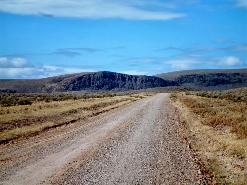
Heading down a small dirt road, looking for camping
There weren’t any trees to park behind, so we chose to park by some BLM equipment, feeling that people would leave the rig alone if it was near government equipment.
Wednesday we woke up to an even windier day.  It would rip the doors of the RV and trailer right out of our hands.  But we went riding anyway.  It was in the 40’s, so not real cold, but the wind chill factor made it feel like 25.  We started out following a track I made that would take us to intersect the TAT, the trail we will ride next year.  Unlike the routes I made for the Pahsimeroi, the roads on my maps are not all there anymore.  Fire has come through and obliterated many of them.  So we had to take the highway a bit, until I found a road that would work.
We started out across the desert
The clouds were pretty low
Obviously no cows in this area, there was still grass left to turn orange and contribute to the color
We found these hot springs
This was a bath house in the truest manner.  It was a covered pool.
It was a very hot fast stream
When we saw the hot springs from down the road we first thought that the steam was the dust from a car coming our way, then I thought maybe dust devils. 
Nope, it was a major hot springs.
It bubbles from the ground in many places, all of them very hot.  This resort may have been abandoned due to the water getting too hot to get into.  We couldn't find a cold water source to cool it down.
Checking out the old building
It really was a pool
From there we spent some time trying to get to where the TAT would cross our route. We followed cow trails and jeep roads across the desert until we got tired of crossing private land.  We then went really cross country to get to the Cordero Mine Road.  Here we picked up the TAT.  It was paved, but we soon left that to play in the dirt.
We started on a big car road
Went by some cool looking rocks
It was a long and winding road….
Disaster Peak is on the right, Little Peak on the left
We came pretty close to Little Peak
We went down China Creek, finding a place for lunch.  This area was part of a large fire area, looks like maybe 5 years ago
This old house was up Kings River
Along Kings River
On Log Cabin Creek
We continued following the TAT until we got to Denio Junction.  Not much of a town, just a couple of homes.  This put us on Highway 140.  We went north to Cottonwood Creek Road.  Here we found more private land, so we abandoned our planned route and after talking to a local and checking out his advice on my laptop (that I carried in my backpack for just this reason) we headed up the Whitehorse Ranch Road.  This was a big car road.  It was now after 4 PM and we wished we could find gas somewhere, just in case, but no such luck.  At one stop I decided to try to get my GPS to plan us a route back to camp, as I couldn’t figure out how to make some roads connect.  Sure enough (love my Garmin!!) I put in McDermitt and it created a route!
The long, very straight, White Horse Cutoff road saved us about 20 miles of cold highway riding
The route then had us turn left on the Oregon Canyon Road, which was part of my original return route.  This brought us to the highway, right across from where we were parked, how cool was that.  Our spot looked a little different, 3 trucks and trailers had come to camp near us, because they were white we saw them before our own rig, but we knew we were home.  It was just before 6 PM, the sun was still up and we had put in 176 miles.  We got to pre-ride some of next year’s route, and didn’t find anything real tough or scary.  When someone else plans a route, you never know what you are going to find.  I was happy with what we found.

Thursday was a travel day; we got to our new home in Reno in the afternoon. 
We passed by Sawtooth Mountain
We saw this strange cloud, maybe it’s a fire

We will be in Reno until the end of December when we will begin our next adventure, traveling to Daytona Beach Florida for bike week.  I may not post much before we leave as we will be working and don’t know how much riding we will be doing. But if we ride, I’ll post.  I promise!


October 6 & 7, 2013 Final Rides in Idaho


On Sunday Wayne and I went for a final adventure ride for this season in Idaho.  We still had not been to Atlanta, a small mining town on the Middle Fork of the Boise River.  Fires seem to hit this area almost every year, and this year was no exception.  We also wanted to check out the Baumgartner Campground on the south fork of the Boise.  We heard that Kelly Creek had burned this year.  This is where we spent the first week of the summer ride.  (See June 24th post titled Baumgartner – Summer Ride Part 1).  We have camped here almost every summer for the last 20 years, and it would be a shame if it all went up in flames…
We left Idaho City while it was still pretty cold, but the sky was blue and mostly clear, so it looked like it could be a great day for riding.  We began on the road we finished on last ride, the Rabbit Summit Road, heading over to the north fork of the Boise River.  Instead of crossing the river at Barber Flats we continued upstream until the road turned and went up and over Swanholm and down to the Middle Fork.

Along the Swanholm Road
On Swanholm and also on the Middle Fork Rd we passed, and then re-passed a guy on is BMW GS.  He seemed to be having problems with the gravel, didn’t look like it was his favorite road type.  He was interesting to follow until we could pass him.  We continued upstream to Atlanta.
This dam is on the way to Atlanta

The hill near Atlanta has burned in the past.  This year’s fall color makes it look like it is on fire now
Atlanta was founded in 1864 during the Civil War as a gold and silver mining community and named by Southerners after a rumored Confederate victory over General Sherman in the Battle of Atlanta, which turned to be wholly false, but the name stuck. Mining activity near Atlanta preceded its establishment as a mining community. The John Stanley party discovered gold on the nearby Yuba River on July 20, 1864, just two days prior to the battle back in Georgia. That November, John Simmons made the discovery of the Atlanta lode which contained both gold and silver.
Atlanta is at 5,383 feet (1,641 m) above sea level surrounded by the Boise National Forest. The Sawtooth Mountains are directly north, the Sawtooth Wilderness starts about a mile (1.6 km) north of Atlanta, at the base of Greylock Mountain, which summits at 9,363 feet (2,854 m).  This year during the fire, the firefighters tried to herd the fire towards the wilderness area and away from the homes and business of Atlanta.  It appears to have worked, as the town is still intact.  We had lunch at the Beaver Lodge, who was having a fundraiser for the firefighters.  Biscuits and gravy, yummmm…  While we were eating, the guy on the BMW GS finally got to town, passing us by and going who knows where.
Wayne leaving town
We left town on the James Creek Road, finding snow just a short distance up the road.  We continued on towards Featherville.  We passed this monument to the 1870’s Firefighters and Muleskinners.
“We honor those brave men who plied John Hailey’s stage route from the Kelton Utah railhead on the Transcontinental Railroad (20 miles west at the Promontory, Utah Golden Spike). They supplied the central Idaho mining towns with goods and the heavy mining equipment leading to the economic development of the Idaho Territory.”  Kelton is now a ghost town, just north of the Great Salt Lake, in the Park Valley area of Box Elder County, Utah. The town was inhabited during the period of 1869–1942.
The Firefighters Monument on James Creek

At Featherville we headed up river to Baumgartner.  Here we found evidence of the fire, but not the devastation of the Elk Complex fire near Prairie. (See October 3rd – Wayne Finally rides his DRZ post). 
Here the fire looks spotty, resembling trees killed by the Pine Beetle.
The south side of the river, where we usually camp, is closed due to possible falling trees and mudslides.  We hope that it will be opened by next summer.
After checking out the Kelly fire we went back to Featherville, and then up to the Phifer Creek Road.
Wayne at the intersection of Trinity Ridge Road and Phifer Creek Road
At the bottom of Phifer Creek we went back up Swanholm, but turned right on Little Owl Creek Road.  Guess who we came upon?  Yep, GS Guy.  He doesn’t look any more comfortable now than he did earlier!  Oh well, we passed him, turning on a small Forest Service road that took us up and over a road we call Willow that takes us to the Crooked River Road. It is very curvy and tons of fun.  I love to make my bike growl up and around the corners.  Sliding would be nice, but I’m on the big, heavy DRZ and I haven’t figured out how to slide it yet.  When we got to the bridge at the Crooked River, I asked Wayne if he had seen GS Guy, but he said no. Too bad, this was the road he was on when we last saw him.  It would have been really funny to see him there.
After Willow we headed over to Highway 21 and headed back to Idaho City.  It is a great highway section with many hairpin turns.  Wayne took off and if he hadn’t waited for me before the city limits, I might not have caught him before we got to our friends house.  He was having WAY too much fun!!! We put in 175 miles and had a wonderful ride.
 
Monday brought the last ride in Idaho for 2013.  Wayne had to stay in town, we finally sold our other trailer and someone needed to be there.  I got to ride as Wayne went to this same area earlier in the week.  It was a true Dual Sport ride.  We did highway, pavement, dirt roads, two track roads and single track trails.  It was so much fun.  I haven’t taken my KTM out for a ride for a long time, like maybe July??  With traction in premium condition, we zoomed around, sliding around corners and having too much fun to be legal. The grins just never stopped coming!!!
The forest was bleeding orange, everyone was on a KTM!!
The roads were soft and plenty of traction
We had lunch on one of the single track trails
We overlooked Placerville
After lunch we headed to an overlook above the Payette River; Garden Valley in the distance
Another fine little road to zoom down
A few skid marks on the road never hurt…
The way to the overlook
The Payette River below us
We did 76 miles, and we all had a great ride.  My friend Cindy was on her new KTM 350 and we spent the whole day chasing each other around the woods.  It’s one of our favorite things to do!!!! What a wonderful way to end our season of riding in Idaho!


Tuesday, October 8, 2013

October 3, 2013 Wayne finally takes his DRZ out for a ride!!

We are finally back at our friends JD and Raydonia’s place in Idaho City.  The next Fall Ride is about to start. They expect Walt and Pat on Saturday, Doc and Cindy on Sunday and Michele and John should get here near the end of the week.  Too bad we have to leave on Tuesday to head to Nevada to work for Amazon.com.  To make room for all the rigs I the back, we have parked in our more typical location, in front of the house.
The cats love to be parked out front; they can spend more time on the porch, while still keeping our house in sight.
 Wednesday was our first opportunity to ride; the rain had stopped and we didn’t have any errands to run in Boise.  Wayne and I decided to go check out the damage done by this year’s fires. As this was all roads he finally got a chance to ride his new-to-him DRZ 400. 

This is the bike he will ride when we take our coast to coast ride next summer.
Getting ready to go
Wayne always checks the bikes and takes care of issues before they happen
We left Idaho City in clear but cold conditions (barely 40 degrees) and headed south on Highway 21, taking a left on Thorn Creek Road.  At the saddle we continued down the other side past Cottonwood Campground.  Here we turned upriver along the Middle Fork of the Boise River.

Arrowrock Dam has created this reservoir
Check out the Eagle
Wayne up ahead, I stop to warm my hands
The colors look out of place here with all the gray earth and scrub brush
This hints at what the river must have been like before the dam
We followed the river to the first bridge across.  This take us up Slide Gulch and eventually over the top and into Long Gulch. Did I say it was cold??
Looking back down Long Gulch
Long Gulch takes us to the small town of Prairie, ID, the location of the Elk complex fire.  The Elk Fire resulted from several lightning fires burning together on the night of August 8th.  It burned 131,258 acres in the Prairie, Falls Creek, and Pine area.  We had large fires last year in this general area, but they appear to be very spotty compared to this guy.  We left Prairie and it seemed as if town ended and the fire began. And it was a huge, hot fire.  I’ve never seen so many miles of this level of damage.  It was very sad to see.
Burnt Creek is on the east end of town, pretty prophetic if you ask me
On the same road
Burn in the distance and all around Wayne
We climbed up the House Mountain Rd and saw this along the way.  That is not water, but sand that has washed into the creek bottom.  Imagine what it will be like after a rainy season…
Even in a badly damaged area like this, Mother Nature starts over again
We followed the road down to the Fall Creek area
Fall Creek was hit really hard by the fire. Thirty eight residences and 43 outbuildings in the Fall Creek area were destroyed by the Elk Complex of fires.  The route we usually ride takes us right through their little neighborhood.  Today, only one house was still standing and it looked like someone had wrapped it in one of those fire retardant wrappings they sometime use.  It was pristine while everything else was burned to the ground, leaving only stone fireplaces and melted equipment. 

We continued to ride through horrible fire ravaged areas and past a Forest Work Station that was saved.  The area around it was not.
Shortly past the Forest Service Work station
From the distance you can see the living, the dead and the dying trees
 
We went through some additional damage on private land before we got to Anderson Ranch Reservoir. It was interesting to see that here as well as in Fall Creek, the land owners are logging out the damaged trees that will either cause problems down the road as well as those that are worth some money at this point.  You know they won’t be worth much down the road. 

Anderson Ranch Reservoir is so low that only the river remains at this point 

We continued along the reservoir, heading to Pine. Once on the pavement we continued to see damage.  The large homes in this area were saved, but damage is still evident.  One house had a 2 rail fence, obviously of vinyl based on how loopy and melted it was.  The old (and still in use) one room school house was saved, but the fire came all the way down to the road across from it.  We rode north to Featherville for lunch, checking out the fire damage along the way.

Lunch at the cafĂ©, hot food and warmth, boy did we need it!  Did I mention it was COLD!!!

Look!  A matched set!

From Featherville we back-tracked a bit to the Trinity Mountain Road and headed back to Idaho City.  This road winds around and up creek drainages to eventually ‘T’ into the Trinity Ridge Road. We were surprised to find the Forest Service logging along this road; they never seem to be that proactive.  It was nice to see them taking a lot of burned trees off the uphill side of the road.  That means less will fall on the road.
This area looks like to may have burned both last year and this year
This trail will need a lot of help
Snow on the Trinities, did I tell you we were cold?
Yes we were very cold
Burr!!!!
The Trinity Ridge Road took us to the Roaring River Road.  This area burned last year. 
You never used to be able to see the road in the distance, last year’s fire made that possible
Steel Mountain got some snow
This creek is making a comeback after last year’s fire
The road is in very good condition despite the fire
The Roaring River Road ends at the Middle Fork of the Boise, and we went down stream, until we got to Alexander Flats.  This is where the old road to Barber Flats on the North Fork takes off. 
Looking down into the North Fork drainage.
We follow the North Fork for about 5 miles, until the road turns up Rabbit Creek and crosses the summit.  This puts us going down into the Morse Creek drainage, Highway 21 and home.
Rabbit Creek Summit

We got back to the motorhome about 5 PM after going 161 miles and seeing a ton of devastation. It was at times very cold, but always interesting and fun.